


Routes to walk - Benijófar
ROUTES TO WALK
Pasear por Benijófar
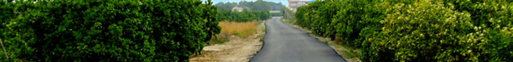
The route 'Pasear por Benijófar', which has been approved as a local path SL-CV 135, has about 4.5 km that are traveled in less than an hour and a half, it starts in the Plaza de la Constitución and its route continues through the Camino de los Rafaeles until you reach the leisure and recreation park El Secano. Running along the river and leaving the crops to the left, you reach La Noria to finish the route with the arrival to the urban center by the Camino Viejo de Orihuela.
The walk is very comfortable since there is practically no slope and it has a great attraction as it runs between the Segura river and the Benijófar orchard, passing besides the 17th century ferris wheel. The trail is marked, as indicated by the regulations, by means of beacons, indicative posts and signs painted with the green and white colors identifying this type of path.
It also has an interpretive work through different panels that inform about the characteristics of the path and recreate the different environments and landscapes that we can observe during the tour.
Cañada Marsá
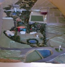
This urban park, which allows the connection between Benimar and the urban center, is designed so that its 125,000 m2 have sensory gardens, lakes, vegetation zone with native species and places for sports and leisure such as a sports circuit, tracks for bicycles, exercise area and an open-air theater.
'Cañada Marsá', whose works are being undertaken in phases, is a respectful place with the environment where not only green areas are promoted but also clean energies, such as solar energy, which will serve to give service to the leisure area of the Park.
At this time, the Park has two phases already built, which represent 45,000m2, which are those of the Embarcadero area, with a large lake, and those corresponding to the south and west where the area has been reforested with native plants and garden areas have been created. In addition, you can enjoy tables, benches and barbecues.
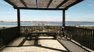
El Secano

This natural landscape is located on the banks of the Segura River, passing through Benijófar, in an old meander, that is, in a grove. It has created an environmental recreational park, equipped with sports and leisure facilities.
The area is landscaped with autochthonous arboreal species, among which tables with benches and barbecues are distributed, destined to spend a complete day of field. In the Park of 'El Secano' you can also practice hiking, football, cycling and river walks.
To get to this park from the municipality you have to start from the Plaza de la Constitución, along the Camino de los Rafaeles.
Guardamar del Segura
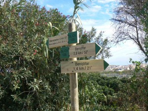
We can also enjoy a tour from our garden to the mouth of the Segura River in Guardamar. It is a route that can be done by bicycle or by walking. The route is made up of a length of approximately 11 kilometers and where you can observe all the fauna and flora that the Segura River houses in its last stretch. The route runs from the Plaza de la Constitución, towards the leisure and recreation park El Secano, after the arrival of the river mota, it would go towards Guardamar, leaving our garden on the right margin.
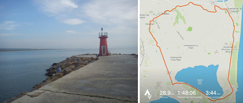
The route ends at the Guardamar lighthouse, where the Segura River empties. If it's summer you can even take a swim on its shores.
Parque Natural de las Lagunas de La Mata - Moncayo - Guardamar - Rojales
This route consists of a length of 35 kilometers approximately, with a medium-high difficulty and with a duration of 3 hours. On this route we can enjoy first hand the orchard and fields of the Vega Baja. The route runs from the Plaza de La Constitución along the main avenue of Benijófar, towards Torrevieja. Later, and thanks to the bike lane that there is up to Torrevieja, we can reach the Lagunas de la Mata. We can also follow Torrevieja direction and get to Laguna Rosa de Torrevieja.
The route runs through the Laguna de La Mata with a small break in the paradors it has. Here you can see the fauna and flora of the Vega Baja.
We finish the stretch of Lagunas de La Mata and head north along the bike path until we reach the Moncayo viewpoint. Point where you can rest while watching the Mediterranean Sea. Then, we continue south until we reach Guardamar, we cross the town until we reach the Segura River, from there we continue west towards Benijófar, passing by Rojales. The route ends at the starting point, La Plaza de la Constitución.
Ruta GR - 330, “la Gran Ruta Costa Blanca Interior”
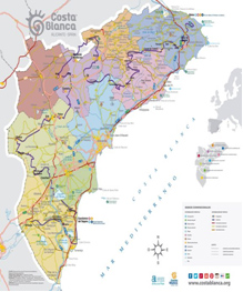
In addition, Benijófar is part of the route GR - 330, "the Great Costa Blanca Interior Route", which through 457 kilometers and 20 stages runs through the province of Alicante from north to south. Benijófar is part of stage number 20 that runs from Benijófar (starts on Calle Primero de Mayo) to Orihuela.
This tour is going to be a good claim to attract quality tourism to the province of Alicante and will allow to deseasonalize the demand, promote sustainable tourism and enhance the natural, cultural and gastronomic heritage that treasures the interior of the province.
Benijófar is committed to a tourism where our essence, the garden, takes on an important role and where we can create good practices with the environment and a balance between the environment and society.
CYCLIST ROUTES
Ruta GR-330 Etapa 20 Benijófar – Orihuela
Simple route that runs along the margin of the Segura River, located in the Vega Baja del Segura. We will cross extensive orchard landscapes and we will pass next to towns such as Formentera del Segura and Benejúzar. During the tour we will see numerous aquatic birds that inhabit this place. At our step we will find explanatory panels on the fl ora and local fauna, as well as recreational areas located in the groves of the river, where we can take a rest and enjoy the tranquility of this journey.
We start from Benijófar on Primero de Mayo street and continue northwest along a paved road between crop fields. We continue until we reach a dirt track, just on the right bank of the Segura River. We continue on this track to the left. A large metal bridge crosses the left bank of the Segura River, which we will cross in case we want to visit the town of Formentera del Segura. A little further on we find the Noria de Benijófar, cataloged as an Asset of Cultural Interest by the local government for its historical-artistic, architectural and hydrological character. It is a hydraulic assembly that was built with masonry walls in the mid-s. XVII and that currently has an iron wheel of 7.70 m. diameter. It constitutes a symbol of the orchard and local customs. Continue through this quiet and comfortable dirt track enjoying the Segura River and the continuous recreational areas arranged in the copses of the river, riverside areas populated with trees and shrubs, where we can take a break. T
Cerrar [X]Uso de cookies
Utilizamos cookies propias y de terceros para mejorar nuestros servicios y recopilar datos estadísticos sobre hábitos de navegación. El uso de cookies es necesario para la notificación de incidencias. Si continúa navegando, consideramos que acepta su uso. Puede obtener más información, o bien conocer cómo cambiar la configuración, en nuestra Política de cookies